Common Land Surveyor Terms Every Homeowner Should Know
Navigating the world of land surveying can be confusing without a glossary of key terms. Whether you’re buying a home, installing a fence, or planning an addition, understanding these concepts will help you communicate effectively with your surveyor and interpret your survey documents.
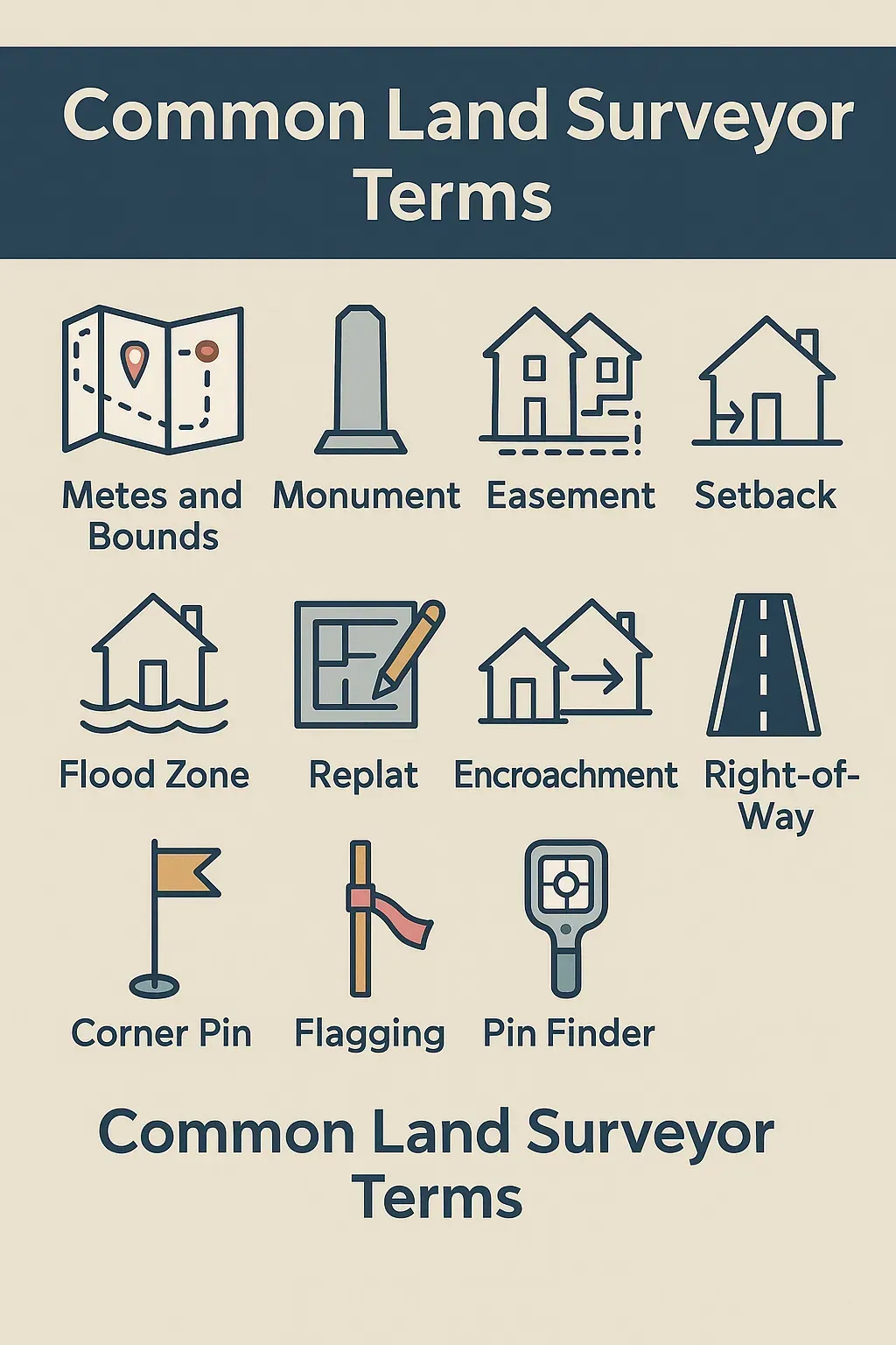
1. Metes and Bounds
Metes are imaginary lines that extend from one point to another, defined by direction and distance. Bounds are the physical landmarks or features (such as trees, roads, or monuments) that mark where one metes line ends. Together, “metes and bounds” describe the perimeter of a property in legal descriptions.
2. Monument
A monument is a physical marker placed at a property corner or along a boundary line. Monuments can be iron rods, concrete piers, stone markers, or other durable objects that establish legal survey points on the ground.
3. Easement
An easement is a legal right for someone other than the property owner to use a portion of the land for a specific purpose—such as utilities, access roads, or drainage. Easements are recorded on the survey and in the deed records to inform current and future owners.
4. Setback
A setback is the minimum distance a structure must be placed from a property line, street, or easement, as defined by local zoning regulations. Setback lines ensure buildings do not encroach on public right-of-way or neighboring properties.
5. Flood Zone
A flood zone classification, determined by FEMA, indicates the risk level of flooding on a property. Zones range from low-risk ( Zone X ) to high-risk ( Zones A, AE, VE ). Surveyors include flood zone information on title surveys to inform insurance and permitting requirements.
6. Replat
A replat is a revision of an existing recorded plat to adjust lot lines, combine parcels, or change easement locations. Property owners use replats when subdividing land or resolving boundary issues.
7. Encroachment
An encroachment occurs when a structure or improvement (like a fence, shed, or driveway) crosses over the legal property line. Surveyors identify and document encroachments so owners can address conflicts or obtain variances.
8. Right-of-Way
A right-of-way is a type of easement granting public or private entities the right to pass over or use specific portions of land—commonly for roads, utilities, or pedestrian pathways.
9. Benchmark
A survey benchmark is a permanent reference point with a known elevation, used to establish vertical control on a site. Benchmarks ensure consistency in elevation measurements across different surveys.
10. Contour Line
Contour lines connect points of equal elevation on a topographic map, illustrating the shape and slope of the terrain. Closely spaced lines indicate steep slopes, while widely spaced lines show gentle grades.
11. Corner Pin
A corner pin(also called a corner stake) is a physical object—often a metal rod or wooden stake—set in the ground to mark the precise corner of a property boundary. Surveyors place or verify these pins during boundary surveys to define legal property limits.
12. Flagging
Flagging refers to the use of brightly colored tape, usually tied to stakes or vegetation, to visually mark survey points, easement lines, or areas of interest on the land. It helps both the survey crew and property owners identify important locations at a glance.
13. Pin Finder
A pin finder is a specialized electronic device that helps surveyors locate buried or hidden corner pins and monuments. Using principles similar to metal detection, it guides the surveyor to the exact spot without extensive excavation.
14. Adjoiner
An adjoiner is the neighboring property owner whose land shares a boundary with your property. Survey reports frequently list adjoiner names and parcels so you know who owns the adjacent lots and can coordinate access or resolve boundary questions.
Have Questions About Your Survey?
Our team at Alliance Land Surveyors is here to help explain your survey results and clarify any terms. Contact us for a consultation: